|
|
||
|
||
画卷-44(中国、甘孜、2017) |

 纠错/违规及不良内容举报
|

画卷-44(中国、甘孜、2017)
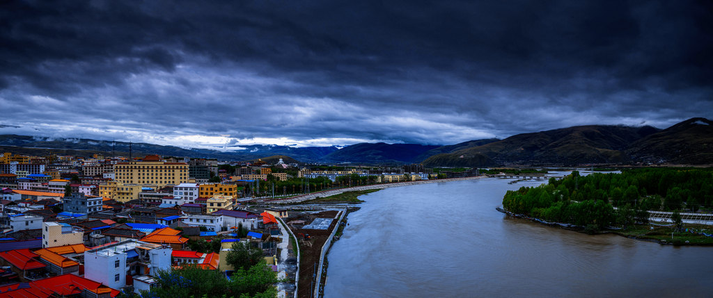
这是川西依雅砻江而建的甘孜县城全景图(非康定也)。甘孜藏族自治州,四川省辖自治州,简称甘孜州,康藏高原东南,总面积15.3万平方千米,是一个以藏族为主体民族的地级行政区,俗称康巴地区或康区,是中国第二大藏区—康巴的主体和腹心地带。境内地形在全国地势上属四川盆地和云贵高原之间的过渡地带。
Scroll -44 (China, Ganzi, 2017)
This is a panoramic view of Ganzi County (not Kangding also) built on the Yalong River in western Sichuan. Ganzi Tibetan Autonomous Prefecture, Sichuan Province Autonomous Prefecture, referred to as Ganzi Prefecture, southeast of the Kangzang Plateau, with a total area of 153,000 square kilometers, is a prefecture-level administrative region with Tibetans as the main ethnic group. District-the main and ventral area of Kham. The terrain within the territory of the country belongs to the transition zone between the Sichuan Basin and the Yunnan-Guizhou Plateau.